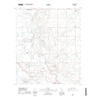
2020 Map of Sligo
USGS Topo · Published 2020About this map
The Red Chute Bayou and Flat River floodplains define the landscape southeast of Bossier City, where a complex network of bayous and lakes meets the agricultural and residential outskirts of Bossier Parish. The map documents a diverse geography ranging from the oxbow-rich lowlands of Buzzard Roost Bend to the established settlements of Sligo and Haughton. Genealogists will find a wealth of data in the numerous family and community burial grounds, including the Oakland Cem and Waterloo Church Cem, which are often the last remnants of earlier rural congregations. The presence of features like Barksdale's Mighty Deuce reflects the specialized land use in this corridor, while the boundary of the Caddo Parish line at Long Point highlights the historical political geography along the river's path.
Find a feature on this map
99 named features on this map. Tap any name to fly to it.
Don’t see what you’re looking for? This feature index may not catch every label — zoom into the map to look around manually.
Map Details
Editions of this 2020 Sligo Map
This is the sole edition of this map. No revisions or reprints were ever made.
Other maps of this area

1932 · Bossier SE
USGS Topo · 1:31,680

1932 · Bossier SW
USGS Topo · 1:31,680

1938 · Arnsberg
USGS Topo · 1:31,680

1941 · Forbing
USGS Topo · 1:31,680

1941 · Bossier Point
USGS Topo · 1:31,680

1947 · Ringgold
USGS Topo · 1:62,500

1947 · Minden
USGS Topo · 1:62,500

1948 · Bossier City
USGS Topo · 1:62,500

1948 · Caspiana
USGS Topo · 1:62,500

1949 · Minden
USGS Topo · 1:62,500