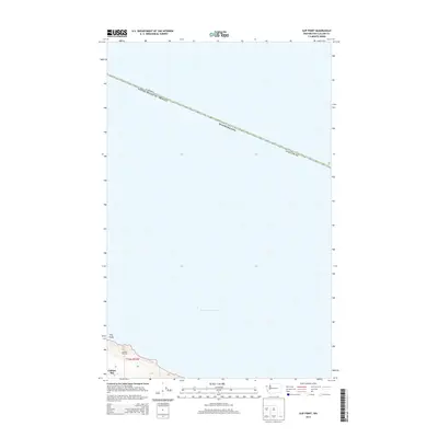
2014 Map of Slip Point
USGS Topo · Published 2014About this map
The Strait of Juan de Fuca dominates this maritime border region, where the international boundary between Canada and the United States aligns across the open water. This 2014 survey captures the coastal transition at Clallam Bay and the prominent Slip Point at the southwestern corner of the sheet. The landscape here is defined by the narrow Clallam Bay Spit and the steep elevation changes rising immediately from the shoreline of Washington state. While much of the map illustrates the hydrography of the shipping lanes, the coastal labels provide a precise record of the rugged shoreline topography and the northern extent of township t32n r12w.
Find a feature on this map
9 named features on this map. Tap any name to fly to it.
Don’t see what you’re looking for? This feature index may not catch every label — zoom into the map to look around manually.
Map Details
Editions of this 2014 Slip Point Map
This is the sole edition of this map. No revisions or reprints were ever made.
Other maps of this area

1922 · Pysht
USGS Topo · 1:62,500

1935 · Clallam
USGS Topo · 1:62,500

1935 · Lake Pleasant
USGS Topo · 1:62,500

1942 · Pysht
USGS Topo · 1:62,500

1942 · Clallam
USGS Topo · 1:62,500

1942 · Lake Pleasant
USGS Topo · 1:62,500

1953 · Cape Flattery
USGS Topo · 1:250,000

1957 · Lake Pleasant
USGS Topo · 1:62,500
1957 · Pysht
USGS Topo · 1:62,500
1957 · Clallam Bay
USGS Topo · 1:62,500