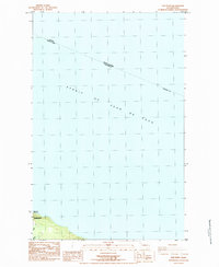
1984 Map of Slip Point
USGS Topo · Published 1984About this map
Strait of Juan de Fuca dominates this 1984 maritime survey, which marks the international boundary line between the United States and Canada. The map focuses on the northwestern coastline of Clallam Co, where the Clallam River meets the sea just west of the prominent headland at Slip Point. This shoreline area is defined by the Slip Point Lighthouse and the adjacent US Coast Guard Reservation, indicating the point's significance for navigation in these international waters. Further inland, the landscape includes a Marsh and a localized Trailer Park, reflecting the intersection of maritime infrastructure and recreational settlement on the Olympic Peninsula during the early 1980s.
Find a feature on this map
10 named features on this map. Tap any name to fly to it.
Don’t see what you’re looking for? This feature index may not catch every label — zoom into the map to look around manually.
Map Details
Editions of this 1984 Slip Point Map
This is the sole edition of this map. No revisions or reprints were ever made.
Other maps of this area

1922 · Pysht
USGS Topo · 1:62,500

1935 · Clallam
USGS Topo · 1:62,500

1935 · Lake Pleasant
USGS Topo · 1:62,500

1942 · Pysht
USGS Topo · 1:62,500

1942 · Clallam
USGS Topo · 1:62,500

1942 · Lake Pleasant
USGS Topo · 1:62,500

1953 · Cape Flattery
USGS Topo · 1:250,000

1957 · Lake Pleasant
USGS Topo · 1:62,500
1957 · Pysht
USGS Topo · 1:62,500
1957 · Clallam Bay
USGS Topo · 1:62,500