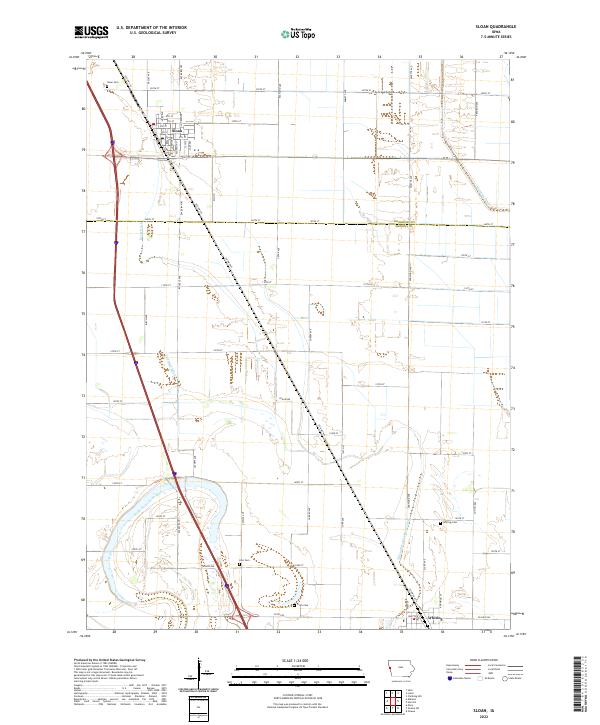
2022 Map of Sloan
USGS Topo · Published 2022About this map
Sloan stands as the primary settlement on this Woodbury County landscape, structured by a grid of streets including Elm St, Cedar St, and Alderson St. The surrounding terrain is defined by an extensive drainage network essential for the region's agricultural productivity, featuring the Boyer Ditch, Swanson Ditch, and the long McCandless Cleghorn Ditch. These waterways reflect the engineering required to manage the flat prairie lands of western Iowa.
Find a feature on this map
68 named features on this map. Tap any name to fly to it.
Don’t see what you’re looking for? This feature index may not catch every label — zoom into the map to look around manually.
Map Details
Editions of this 2022 Sloan Map
This is the sole edition of this map. No revisions or reprints were ever made.
Other maps of this area

1955 · Sioux City
USGS Topo · 1:250,000

1958 · Sioux City
USGS Topo · 1:250,000

1959 · Sioux City
USGS Topo · 1:250,000

1964 · Climbing Hill
USGS Topo · 1:24,000

1964 · Luton
USGS Topo · 1:24,000

1964 · Salix
USGS Topo · 1:24,000

1966 · Macy
USGS Topo · 1:24,000

1969 · Onawa
USGS Topo · 1:24,000

1969 · Albaton
USGS Topo · 1:24,000
1969 · Hornick
USGS Topo · 1:24,000