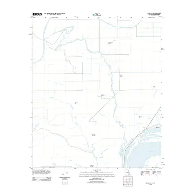
2012 Map of Slocum
USGS Topo · Published 2012About this map
Bayou Cocodrie winds through a landscape dominated by hydrocarbon extraction and low-lying wetlands in Concordia Parish. This area, just north of where the Mississippi River creates the prominent bend at Jackson Point, is defined by a dense network of petroleum production zones. Significant sites include the Slocum Oil Field, Middle Bayou Cocodrie Oil Field, and the West Slocum Oil Field, indicating the region's intensive industrial use.
Find a feature on this map
19 named features on this map. Tap any name to fly to it.
Don’t see what you’re looking for? This feature index may not catch every label — zoom into the map to look around manually.
Map Details
Editions of this 2012 Slocum Map
This is the sole edition of this map. No revisions or reprints were ever made.
Other maps of this area

1935 · Tooleys
USGS Topo · 1:62,500

1939 · Artonish
USGS Topo · 1:62,500

1939 · Deer Park
USGS Topo · 1:62,500

1941 · Voorhies
USGS Topo · 1:62,500

1941 · Tooleys
USGS Topo · 1:62,500

1953 · Natchez
USGS Topo · 1:250,000

1954 · Artonish
USGS Topo · 1:62,500

1955 · Artonish
USGS Topo · 1:62,500

1956 · Natchez
USGS Topo · 1:250,000

1958 · Artonish
USGS Topo · 1:62,500