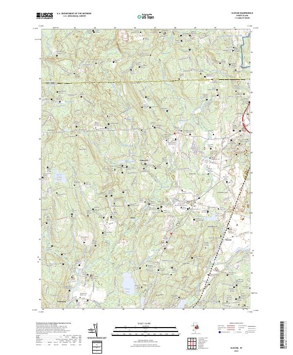
2024 Map of Slocum
USGS Topo · Published 2024About this map
Dozens of small family burial plots and historic cemeteries are scattered across this landscape, reflecting a deep genealogical history in the rural heart of Washington County. From the Niles Nichols Congdon Lot Cem in the north to the Pegleg Slocum Lot Cem near Usquepaug, these sites provide a granular look at the families who established the settlements of Fisherville, Liberty, and Slocum. The terrain is characterized by numerous low-lying wetlands such as Dead Swamp and Money Swamp, which feed into the Queens River and the Wood-Pawcatuck Watershed. Transport is anchored by the Amtrak rail line cutting through the southeast and the historic New London Tpke running north to south. Notable landmarks include the extensive Veterans Memorial Cem and the NG Camp Fogarty TNG Site on the northern border near Kent County.
Find a feature on this map
297 named features on this map. Tap any name to fly to it.
Don’t see what you’re looking for? This feature index may not catch every label — zoom into the map to look around manually.
Map Details
Editions of this 2024 Slocum Map
This is the sole edition of this map. No revisions or reprints were ever made.
Other maps of this area

1889 · Charlestown
USGS Topo · 1:62,500

1889 · Newport
USGS Topo · 1:62,500

1890 · Narragansett Bay
USGS Topo · 1:62,500

1890 · Kent
USGS Topo · 1:62,500

1892 · Narragansett Bay
USGS Topo · 1:62,500

1894 · Kent
USGS Topo · 1:62,500

1894 · Newport
USGS Topo · 1:62,500

1904 · Newport
USGS Topo · 1:62,500

1919 · Charlestown
USGS Topo · 1:62,500

1919 · Narragansett Bay
USGS Topo · 1:62,500