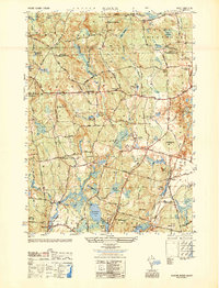
1950 Map of Slocum
USGS Topo · Published 1950About this map
Slocum sits at a geographic crossroads in southern Rhode Island, where the borders of Exeter, North Kingstown, and South Kingstown converge. The landscape is a complex network of wetlands and small water bodies, including Yawgoo Pond, Barber Pond, and the massive Money Swamp. This mid-century view shows a rural infrastructure built around local landmarks like the State Hospital and the South County Museum. Education and spiritual life are anchored by scattered rural institutions such as the Hitty Corner Sch, Chestnut Hill Sch, and Liberty Ch. Economic activity is evidenced by Yorker Mill Pond and Glen Rock, while the regional transport network is defined by the Victory Highway and Ten Rod Road. These features reveal a community transitioning from its mill-town origins into a more specialized institutional and residential landscape.
Find a feature on this map
56 named features on this map. Tap any name to fly to it.
Don’t see what you’re looking for? This feature index may not catch every label — zoom into the map to look around manually.
Map Details
Editions of this 1950 Slocum Map
This is the sole edition of this map. No revisions or reprints were ever made.
Other maps of this area

1889 · Charlestown
USGS Topo · 1:62,500

1889 · Newport
USGS Topo · 1:62,500

1890 · Narragansett Bay
USGS Topo · 1:62,500

1890 · Kent
USGS Topo · 1:62,500

1892 · Narragansett Bay
USGS Topo · 1:62,500

1894 · Kent
USGS Topo · 1:62,500

1894 · Newport
USGS Topo · 1:62,500

1904 · Newport
USGS Topo · 1:62,500

1919 · Charlestown
USGS Topo · 1:62,500

1919 · Narragansett Bay
USGS Topo · 1:62,500