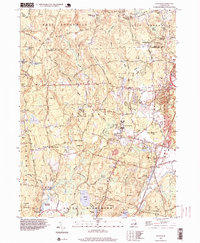
1996 Map of Slocum
USGS Topo · Published 1999About this map
The Queen River and its numerous tributaries, including Pardon Joslin Brook and Fisherville Brook, define the rural character of this southern Rhode Island landscape. The village of Usquepaug sits at the southwestern edge, while Slocum serves as a key rail point along the north-south Railroad corridor. The geography is heavily influenced by glacial remnants, evidenced by the vast Dead Swamp and Bear Swamp, and prominent elevations like Hopkins Hill and Shrub Hill. Local history is anchored by community landmarks such as Liberty Ch, the Baptist Plantation Ch, and the South County Museum. The presence of the State Fish Hatchery and several mill ponds, including Yawgoo Mill Pond, points to the long-standing integration of water resources into the local economy and conservation efforts.
Find a feature on this map
80 named features on this map. Tap any name to fly to it.
Don’t see what you’re looking for? This feature index may not catch every label — zoom into the map to look around manually.
Map Details
Editions of this 1996 Slocum Map
This is the sole edition of this map. No revisions or reprints were ever made.
Other maps of this area

1889 · Charlestown
USGS Topo · 1:62,500

1889 · Newport
USGS Topo · 1:62,500

1890 · Narragansett Bay
USGS Topo · 1:62,500

1890 · Kent
USGS Topo · 1:62,500

1892 · Narragansett Bay
USGS Topo · 1:62,500

1894 · Kent
USGS Topo · 1:62,500

1894 · Newport
USGS Topo · 1:62,500

1904 · Newport
USGS Topo · 1:62,500

1919 · Charlestown
USGS Topo · 1:62,500

1919 · Narragansett Bay
USGS Topo · 1:62,500