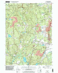
2001 Map of Slocum
USGS Topo · Published 2003About this map
Queens Fort State Hist Park and the rugged topography of Exeter define this central Rhode Island landscape at the start of the 21st century. The map illustrates a dense network of water systems, including Yawgoo Pond, Hundred Acre Pond, and the Nooseneck River, which helped shape early industrial and agricultural nodes like Slocum and Usquepaug. Rural development is visible through landmarks such as the Joseph H Ladd Sch and several family-named crossroads like Hamiltons Corner and Tripps Corner.
Find a feature on this map
76 named features on this map. Tap any name to fly to it.
Don’t see what you’re looking for? This feature index may not catch every label — zoom into the map to look around manually.
Map Details
Editions of this 2001 Slocum Map
This is the sole edition of this map. No revisions or reprints were ever made.
Other maps of this area

1889 · Charlestown
USGS Topo · 1:62,500

1889 · Newport
USGS Topo · 1:62,500

1890 · Narragansett Bay
USGS Topo · 1:62,500

1890 · Kent
USGS Topo · 1:62,500

1892 · Narragansett Bay
USGS Topo · 1:62,500

1894 · Kent
USGS Topo · 1:62,500

1894 · Newport
USGS Topo · 1:62,500

1904 · Newport
USGS Topo · 1:62,500

1919 · Charlestown
USGS Topo · 1:62,500

1919 · Narragansett Bay
USGS Topo · 1:62,500