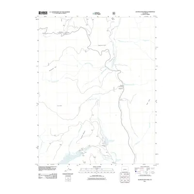
2011 Map of Slumgullion Pass
USGS Topo · Published 2011About this map
Slumgullion Pass and Spring Creek Pass anchor this high-altitude landscape in Mineral County, serving as critical transit points along the continental divide. The 2011 survey documents a complex network of alpine hydrology, where the Continental Reservoir and Rito Hondo Reservoir regulate the flow of the North Clear Creek and Rito Hondo Creek systems. These waters define the drainages between massive topographic features like Snow Mesa and Jarosa Mesa.
Find a feature on this map
33 named features on this map. Tap any name to fly to it.
Don’t see what you’re looking for? This feature index may not catch every label — zoom into the map to look around manually.
Map Details
Editions of this 2011 Slumgullion Pass Map
This is the sole edition of this map. No revisions or reprints were ever made.
Other maps of this area

1903 · Lake City
USGS Topo · 1:62,500

1905 · Lake City
USGS Topo · 1:62,500

1905 · San Cristobal
USGS Topo · 1:125,000

1907 · San Cristobal
USGS Topo · 1:125,000

1908 · Uncompahgre
USGS Topo · 1:125,000

1911 · Uncompahgre
USGS Topo · 1:125,000

1945 · Durango
USGS Topo · 1:250,000

1953 · Durango
USGS Topo · 1:250,000

1954 · Durango
USGS Topo · 1:250,000

1956 · Montrose
USGS Topo · 1:250,000