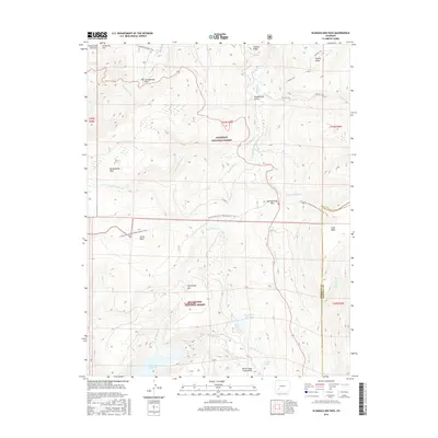
2016 Map of Slumgullion Pass
USGS Topo · Published 2016About this map
The Slumgullion Earthflow and Slumgullion Slide dominate the northern landscape of this Mineral County survey, where the high-altitude divide between the Gunnison National Forest and Rio Grande National Forest is clearly defined. This region is a complex of volcanic plateaus and alpine meadows, featuring prominent landforms like Jarosa Mesa and Snow Mesa. High-altitude transportation is concentrated along the route crossing Slumgullion Pass and Spring Creek Pass, while foot travel follows the Continental Divide National Scenic Trail. Water management is evident through the presence of the Rito Hondo Reservoir and the Continental Reservoir at the southern edge, which capture snowmelt from peaks like Horsethief Mtn and ridges such as Gardner Ridge. The map illustrates the headwaters of numerous drainages, including Slumgullion Cr and the various forks of Cebolla Cr.
Find a feature on this map
39 named features on this map. Tap any name to fly to it.
Don’t see what you’re looking for? This feature index may not catch every label — zoom into the map to look around manually.
Map Details
Editions of this 2016 Slumgullion Pass Map
This is the sole edition of this map. No revisions or reprints were ever made.
Other maps of this area

1903 · Lake City
USGS Topo · 1:62,500

1905 · Lake City
USGS Topo · 1:62,500

1905 · San Cristobal
USGS Topo · 1:125,000

1907 · San Cristobal
USGS Topo · 1:125,000

1908 · Uncompahgre
USGS Topo · 1:125,000

1911 · Uncompahgre
USGS Topo · 1:125,000

1945 · Durango
USGS Topo · 1:250,000

1953 · Durango
USGS Topo · 1:250,000

1954 · Durango
USGS Topo · 1:250,000

1956 · Montrose
USGS Topo · 1:250,000