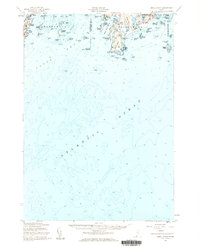
1957 Map of Small Point
USGS Topo · Published 1960About this map
The rocky peninsulas and islands of Phippsburg and Harpswell define this coastal survey of the Midcoast region. Focused on the entrance to the Kennebec River, the map highlights the strategic military significance of the area with U S Mil Res Fort Baldwin and the historic Fort Popham guarding the approach at Popham Beach. The landscape is a complex network of sounds and harbors, including Small Point Harbor and Merriconeag Sound, which supported the local maritime economy.
Find a feature on this map
89 named features on this map. Tap any name to fly to it.
Don’t see what you’re looking for? This feature index may not catch every label — zoom into the map to look around manually.
Map Details
Editions of this 1957 Small Point Map
4 editions found
Other maps of this area

1892 · Freeport
USGS Topo · 1:62,500

1893 · Small Point
USGS Topo · 1:62,500

1893 · Casco Bay
USGS Topo · 1:62,500

1893 · Boothbay
USGS Topo · 1:62,500

1894 · Bath
USGS Topo · 1:62,500

1914 · Casco Bay
USGS Topo · 1:48,000

1916 · Casco Bay
USGS Topo · 1:62,500

1916 · Portland And Vicinity
USGS Topo · 1:62,500

1918 · Portland And Vicinity
USGS Topo · 1:62,500

1919 · Small Point
USGS Topo · 1:62,500