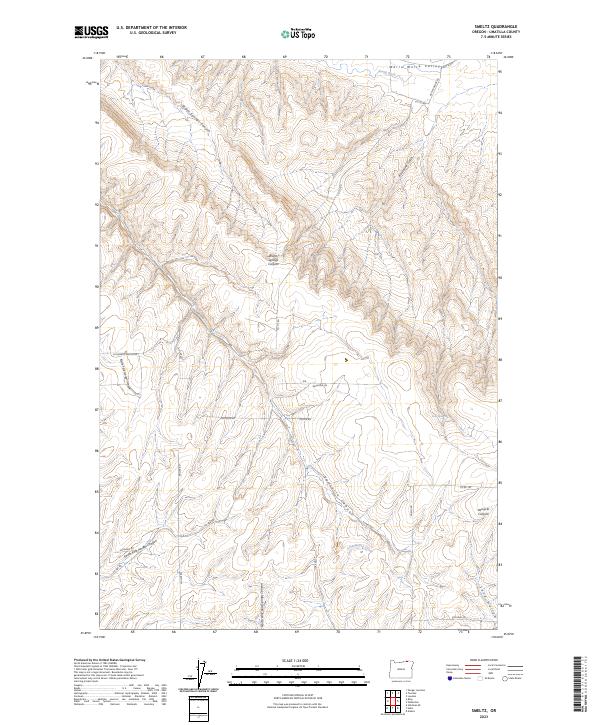
2023 Map of Smeltz
USGS Topo · Published 2023About this map
The Walla Walla Valley defines the northern edge of this Umatilla County landscape, where the terrain transitions into a complex system of deep drainages. Extensive seasonal watercourses like Warm Springs Canyon and Vansycle Canyon carve through the high ground, illustrating a drainage pattern that dictates the placement of local infrastructure. A network of rural routes, including Vansycle Rd and Muller Rd, follows the contours of the land, connecting disparate points like Fruit Spring and the headwaters of Greasewood Creek. The map provides a detailed view of the sectional divisions across townships T6N and T5N, revealing the intersection of physical geography and historical land survey lines. This rural expanse is marked by significant topographical relief, from the low-lying South Ditch to the elevated ridges overlooking Raymond Gulch.
Find a feature on this map
32 named features on this map. Tap any name to fly to it.
Don’t see what you’re looking for? This feature index may not catch every label — zoom into the map to look around manually.
Map Details
Editions of this 2023 Smeltz Map
This is the sole edition of this map. No revisions or reprints were ever made.
Other maps of this area

1915 · Wallulah
USGS Topo · 1:96,000

1918 · Wallula
USGS Topo · 1:125,000

1935 · Pendleton
USGS Topo · 1:125,000

1953 · Pendleton
USGS Topo · 1:250,000

1953 · Walla Walla
USGS Topo · 1:250,000

1956 · Pendleton
USGS Topo · 1:250,000

1958 · Walla Walla
USGS Topo · 1:250,000

1964 · Zangar Junction
USGS Topo · 1:24,000
1966 · Adams
USGS Topo · 1:24,000
1966 · Smeltz
USGS Topo · 1:24,000