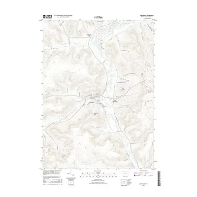
2016 Map of Smethport
USGS Topo · Published 2016About this map
Smethport sits at the confluence of Marvin Creek and Potato Creek in northern Pennsylvania, serving as a focal point for this McKean County landscape. The town’s grid is clearly defined by historical thoroughfares like E Main St and W Main St, while the adjacent East Smethport and the settlement at Farmers Valley to the north highlight the valley’s development pattern. Significant for genealogists and local historians are the established grounds of Rose Hill Cem, Saint Elizabeths Cem, and Smith Cem, which provide tangible links to the area's ancestral residents.
Find a feature on this map
80 named features on this map. Tap any name to fly to it.
Don’t see what you’re looking for? This feature index may not catch every label — zoom into the map to look around manually.
Map Details
Editions of this 2016 Smethport Map
This is the sole edition of this map. No revisions or reprints were ever made.
Other maps of this area

1924 · Bradford
USGS Topo · 1:62,500

1926 · Bradford
USGS Topo · 1:62,500

1933 · Smethport
USGS Topo · 1:62,500

1935 · Mt. Jewett
USGS Topo · 1:48,000

1937 · Smethport
USGS Topo · 1:62,500

1940 · Mt. Jewett
USGS Topo · 1:62,500

1941 · Bradford
USGS Topo · 1:62,500

1944 · Bradford
USGS Topo · 1:62,500

1948 · Crosby
USGS Topo · 1:62,500

1948 · Norwich
USGS Topo · 1:24,000
Featured Places
- Liberty Township, PA
- Smethport, PA
- Norwich Township, PA
- Farmers Valley, Keating Township
- Sergeant Township, PA