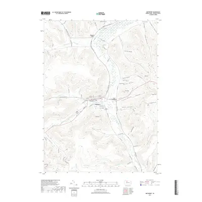
2019 Map of Smethport
USGS Topo · Published 2019About this map
Smethport serves as a focal point of this McKean County landscape, where the confluence of Marvin Creek and Potato Creek helped define the valley's development. The town's civic identity is anchored by the McKean County Courthouse, while local history is etched into the surrounding hillsides at several burial sites, including Rose Hill Cem and the McKean County Farm Cem.
Find a feature on this map
73 named features on this map. Tap any name to fly to it.
Don’t see what you’re looking for? This feature index may not catch every label — zoom into the map to look around manually.
Map Details
Editions of this 2019 Smethport Map
This is the sole edition of this map. No revisions or reprints were ever made.
Other maps of this area

1924 · Bradford
USGS Topo · 1:62,500

1926 · Bradford
USGS Topo · 1:62,500

1933 · Smethport
USGS Topo · 1:62,500

1935 · Mt. Jewett
USGS Topo · 1:48,000

1937 · Smethport
USGS Topo · 1:62,500

1940 · Mt. Jewett
USGS Topo · 1:62,500

1941 · Bradford
USGS Topo · 1:62,500

1944 · Bradford
USGS Topo · 1:62,500

1948 · Crosby
USGS Topo · 1:62,500

1948 · Norwich
USGS Topo · 1:24,000
Featured Places
- Liberty Township, PA
- Smethport, PA
- Norwich Township, PA
- Farmers Valley, Keating Township
- Sergeant Township, PA