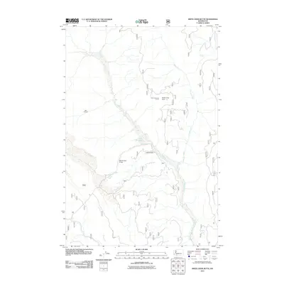
2011 Map of Smith Creek Butte
USGS Topo · Published 2011About this map
Smith Creek Butte Lookout stands as a prominent vantage point overlooking a landscape defined by significant geological transitions and forest service infrastructure. This 2011 survey by the U.S. Geological Survey documents the complex hydrology and terrain near the Muddy River, including the dramatic Muddy River Gorge and the sharp descent of Lava Canyon. The presence of the Jackpine Shelter and the network of forest roads, such as Nat For Dev RD 8320, indicates a region managed for public land use and backcountry access. The drainage patterns are clearly defined by Clearwater Creek, Bean Creek, and Pine Creek, which carve through the high-elevation terrain near Ape Canyon. This map provides a detailed view of the natural features and small-scale human improvements, such as Crane Lake, within the Gifford Pinchot National Forest area.
Find a feature on this map
13 named features on this map. Tap any name to fly to it.
Don’t see what you’re looking for? This feature index may not catch every label — zoom into the map to look around manually.
Map Details
Editions of this 2011 Smith Creek Butte Map
This is the sole edition of this map. No revisions or reprints were ever made.
Other maps of this area

1919 · Mount St Helens
USGS Topo · 1:125,000

1926 · Steamboat Mtn
USGS Topo · 1:125,000

1931 · Steamboat Mtn
USGS Topo · 1:125,000

1950 · Yakima
USGS Topo · 1:250,000

1953 · Hoquiam
USGS Topo · 1:250,000

1957 · Hoquiam
USGS Topo · 1:250,000

1957 · Spirit Lake
USGS Topo · 1:62,500

1958 · Mt St. Helens
USGS Topo · 1:62,500

1958 · Yakima
USGS Topo · 1:250,000

1958 · Hoquiam
USGS Topo · 1:250,000