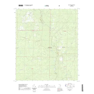
2021 Map of Smith Creek
USGS Topo · Published 2021About this map
The settlement of Smith Creek sits on the eastern bank of the Ochlockonee River, serving as a central point in this heavily forested landscape within the Apalachicola National Forest. The river dictates the geography here, creating a complex border between Wakulla and Liberty counties. This environment is characterized by numerous bays and stagnant water bodies, including Bradwell Bay, Preachers Bay, and Stallion Bay, which indicate the low-lying, poorly drained nature of the Panhandle interior.
Find a feature on this map
69 named features on this map. Tap any name to fly to it.
Don’t see what you’re looking for? This feature index may not catch every label — zoom into the map to look around manually.
Map Details
Editions of this 2021 Smith Creek Map
This is the sole edition of this map. No revisions or reprints were ever made.
Other maps of this area

1943 · Lake Talquin
USGS Topo · 1:62,500

1944 · Queens Bay
USGS Topo · 1:24,000

1945 · Thousand Yard Bay
USGS Topo · 1:31,680

1945 · Smith Creek
USGS Topo · 1:31,680

1945 · Bradwell Bay
USGS Topo · 1:31,680

1945 · Sanborn
USGS Topo · 1:31,680

1945 · Telogia
USGS Topo · 1:24,000

1946 · Queens Bay
USGS Topo · 1:31,680

1946 · Telogia
USGS Topo · 1:31,680

1946 · Owens Bridge
USGS Topo · 1:31,680