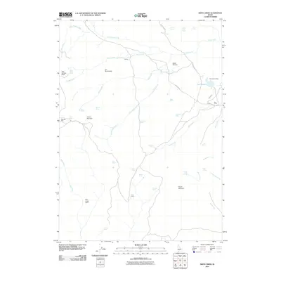
2010 Map of Smith Creek
USGS Topo · Published 2010About this map
Smith Meadow sits at the heart of this high-desert landscape in Owyhee County, where a complex network of springs and seasonal drainages supports remote ranching operations. The eastern portion of the map is defined by the Star Reservoir and Sommerville Dam, providing critical water management for the Star Ranch area. Ranching history is further evidenced by isolated locations such as The Pete and Craig Camp, which serve as markers of human presence in a terrain dominated by significant geological features like The Monuments and Twin Springs Ridge. High-altitude points such as Juniper Mountain and Rough Mountain overlook the many tributaries of Smith Creek and Castle Creek. This 2010 survey details the modern infrastructure of these remote rangelands, including the Grasshopper Rd and various trails that navigate the plateau from Stauffer Flat to Bear Creek Point.
Find a feature on this map
44 named features on this map. Tap any name to fly to it.
Don’t see what you’re looking for? This feature index may not catch every label — zoom into the map to look around manually.
Map Details
Editions of this 2010 Smith Creek Map
This is the sole edition of this map. No revisions or reprints were ever made.
Other maps of this area

1955 · Jordan Valley
USGS Topo · 1:250,000

1957 · Jordan Valley
USGS Topo · 1:250,000

1958 · Jordan Valley
USGS Topo · 1:250,000

1973 · Red Basin
USGS Topo · 1:24,000

1973 · Smith Creek
USGS Topo · 1:24,000

1973 · Bedstead Ridge
USGS Topo · 1:24,000

1973 · Castro Table
USGS Topo · 1:24,000

1973 · Pleasant Valley
USGS Topo · 1:24,000

1973 · Fairylawn
USGS Topo · 1:24,000

1973 · Brace Flat
USGS Topo · 1:24,000