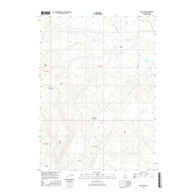
2017 Map of Smith Creek
USGS Topo · Published 2017About this map
Smith Meadow and the surrounding high country of Owyhee County define this landscape, where numerous springs and creeks feed into deep drainages. The topography is marked by significant elevations like Juniper Mtn and Twin Springs Ridge, which separate the watersheds of Little Thomas Cr and the various forks of Castle Cr. Water management in this arid environment is evident through features like Star Reservoir and an extensive network of named water sources, including Beaver Creek Springs and Moonshine Spring. Transportation through these basins is limited to primitive routes such as the Grasshopper Jeep Trl, reflecting the land's primary use for ranching and resource management. Grounded landmarks like Big Tree and Bull Basin provide specific points of reference for those studying the local geography or historical land use patterns in this part of Idaho.
Find a feature on this map
49 named features on this map. Tap any name to fly to it.
Don’t see what you’re looking for? This feature index may not catch every label — zoom into the map to look around manually.
Map Details
Editions of this 2017 Smith Creek Map
This is the sole edition of this map. No revisions or reprints were ever made.
Other maps of this area

1955 · Jordan Valley
USGS Topo · 1:250,000

1957 · Jordan Valley
USGS Topo · 1:250,000

1958 · Jordan Valley
USGS Topo · 1:250,000

1973 · Red Basin
USGS Topo · 1:24,000

1973 · Smith Creek
USGS Topo · 1:24,000

1973 · Bedstead Ridge
USGS Topo · 1:24,000

1973 · Castro Table
USGS Topo · 1:24,000

1973 · Pleasant Valley
USGS Topo · 1:24,000

1973 · Fairylawn
USGS Topo · 1:24,000

1973 · Brace Flat
USGS Topo · 1:24,000