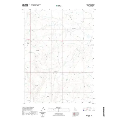
2020 Map of Smith Creek
USGS Topo · Published 2020About this map
Smith Meadow sits at the heart of this high-elevation landscape in Owyhee County, where a complex network of springs and seasonal drainages defines the local geography. The area is characterized by prominent peaks and ridges including Juniper Mtn, Rough Mtn, and Bear Creek Point, which overlook deep incisions like the West Fork Red Canyon. The presence of named water sources such as Star Ranch Spring, Moonshine Spring, and Castlehead Spring suggests the historical importance of water management for ranching and transit in this arid environment. Transportation through the backcountry is limited, primarily represented by the Grasshopper Jeep Trl, which winds through the eastern portion of the quadrangle. This map provides an essential look at the naming conventions and drainage patterns of the region, from the Little Smith Cr to the southern Bull Basin.
Find a feature on this map
48 named features on this map. Tap any name to fly to it.
Don’t see what you’re looking for? This feature index may not catch every label — zoom into the map to look around manually.
Map Details
Editions of this 2020 Smith Creek Map
This is the sole edition of this map. No revisions or reprints were ever made.
Other maps of this area

1955 · Jordan Valley
USGS Topo · 1:250,000

1957 · Jordan Valley
USGS Topo · 1:250,000

1958 · Jordan Valley
USGS Topo · 1:250,000

1973 · Red Basin
USGS Topo · 1:24,000

1973 · Smith Creek
USGS Topo · 1:24,000

1973 · Bedstead Ridge
USGS Topo · 1:24,000

1973 · Castro Table
USGS Topo · 1:24,000

1973 · Pleasant Valley
USGS Topo · 1:24,000

1973 · Fairylawn
USGS Topo · 1:24,000

1973 · Brace Flat
USGS Topo · 1:24,000