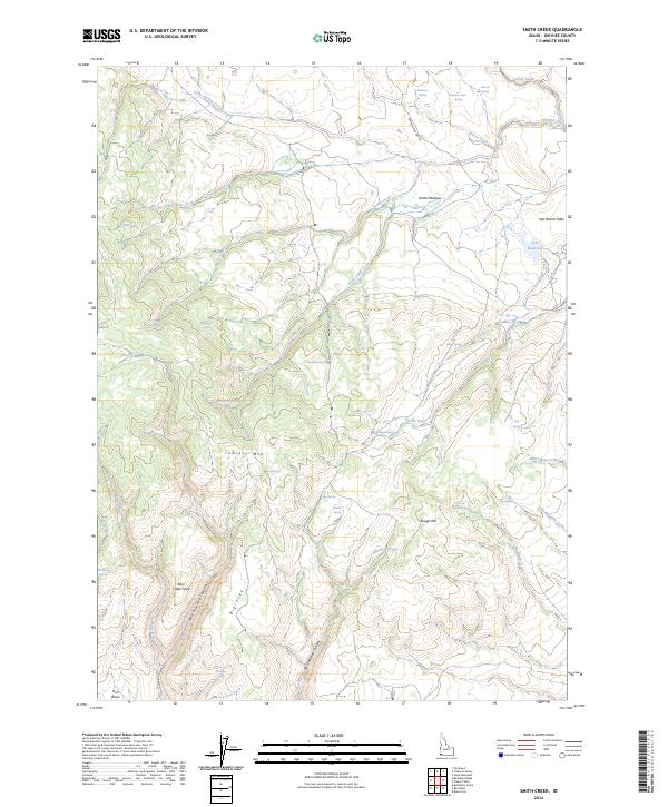
2024 Map of Smith Creek
USGS Topo · Published 2024About this map
Juniper Mtn and Rough Mtn dominate this Owyhee County landscape, where an intricate network of drainages and springs defines the high-desert character of the region. The map highlights the seasonal water systems critical to local ranching and wildlife, including Star Reservoir and several named water sources such as Moonshine Spring and Buckaroo Spring. The topography transitions from the high points of Bear Creek Point down to Smith Meadow, providing a detailed view of the remote ranching infrastructure. Transportation in this area is characterized by primitive routes like the Grasshopper Jeep Trl, which navigates the complex terrain around Little Smith Creek. This survey offers essential detail for those studying the physical geography and land-use patterns in this corner of Idaho, where labels like Star Ranch Table and Bull Basin hint at the long history of livestock movement across the open range.
Find a feature on this map
48 named features on this map. Tap any name to fly to it.
Don’t see what you’re looking for? This feature index may not catch every label — zoom into the map to look around manually.
Map Details
Editions of this 2024 Smith Creek Map
This is the sole edition of this map. No revisions or reprints were ever made.
Other maps of this area

1955 · Jordan Valley
USGS Topo · 1:250,000

1957 · Jordan Valley
USGS Topo · 1:250,000

1958 · Jordan Valley
USGS Topo · 1:250,000

1973 · Red Basin
USGS Topo · 1:24,000

1973 · Smith Creek
USGS Topo · 1:24,000

1973 · Bedstead Ridge
USGS Topo · 1:24,000

1973 · Castro Table
USGS Topo · 1:24,000

1973 · Pleasant Valley
USGS Topo · 1:24,000

1973 · Fairylawn
USGS Topo · 1:24,000

1973 · Brace Flat
USGS Topo · 1:24,000