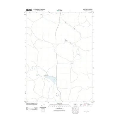
2011 Map of Smith Lake
USGS Topo · Published 2011About this map
Smith Lake and the meandering course of Pine Creek define this section of Sheridan County, Nebraska. This high-plains landscape is characterized by its significant ranching operations, including several family-named estates such as the Blaine and Blake Beguin Ranch and the Bob Beguin Ranch that line the creek's drainage. The presence of the Smith Lake Dam indicates the managed water resources vital for the region's agricultural and ranching livelihood.
Find a feature on this map
10 named features on this map. Tap any name to fly to it.
Don’t see what you’re looking for? This feature index may not catch every label — zoom into the map to look around manually.
Map Details
Editions of this 2011 Smith Lake Map
This is the sole edition of this map. No revisions or reprints were ever made.
Other maps of this area

1948 · Twin Lakes
USGS Topo · 1:62,500

1950 · Twin Lakes
USGS Topo · 1:62,500

1950 · Skunk Lake
USGS Topo · 1:62,500

1955 · Alliance
USGS Topo · 1:250,000

1957 · Alliance
USGS Topo · 1:250,000

1958 · Alliance
USGS Topo · 1:250,000

1960 · Hay Springs SE
USGS Topo · 1:24,000

1966 · Rushville SW
USGS Topo · 1:24,000

1969 · Rushville SE
USGS Topo · 1:24,000
1985 · Gordon
USGS Topo · 1:100,000