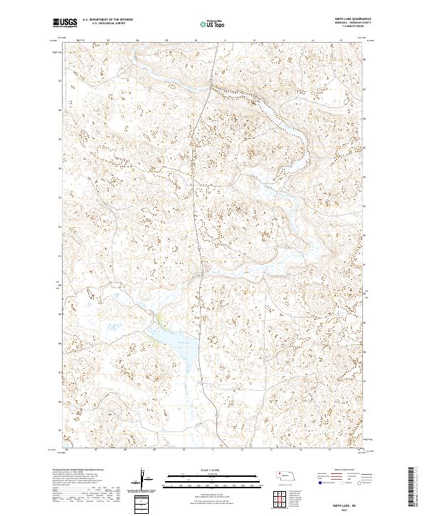
2021 Map of Smith Lake
USGS Topo · Published 2021About this map
Smith Lake and the winding course of Pine Cr define this pocket of Sheridan County, Nebraska. This high-plains landscape is characterized by its hydrological features and a sparse network of ranch roads and trails, including 432 Trl and 432nd Trl which navigate the terrain north of the lake. The survey reflects the enduring section-line organization of the American West, documented here across several townships including t29n r44w and t28n r44w. The absence of dense settlements underscores the rural nature of the region, where movement is dictated by these established trails like 389 Trl and 357th Trl that cut through the open country.
Find a feature on this map
10 named features on this map. Tap any name to fly to it.
Don’t see what you’re looking for? This feature index may not catch every label — zoom into the map to look around manually.
Map Details
Editions of this 2021 Smith Lake Map
This is the sole edition of this map. No revisions or reprints were ever made.
Other maps of this area

1948 · Twin Lakes
USGS Topo · 1:62,500

1950 · Twin Lakes
USGS Topo · 1:62,500

1950 · Skunk Lake
USGS Topo · 1:62,500

1955 · Alliance
USGS Topo · 1:250,000

1957 · Alliance
USGS Topo · 1:250,000

1958 · Alliance
USGS Topo · 1:250,000

1960 · Hay Springs SE
USGS Topo · 1:24,000

1966 · Rushville SW
USGS Topo · 1:24,000

1969 · Rushville SE
USGS Topo · 1:24,000
1985 · Gordon
USGS Topo · 1:100,000