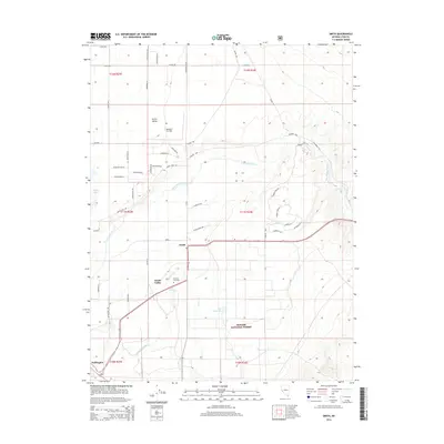
2014 Map of Smith
USGS Topo · Published 2014About this map
The agricultural and desert landscape of Smith Valley unfolds in this 2014 survey, illustrating the critical irrigation network supporting the region. The West Walker River meanders through the valley floor, feeding the Plymouth Canal and Nuti Reservoir, while the northern reaches of the Toiyabe National Forest rise to the south. Small aviation and local heritage are marked by the Rosaschi Air Park and the Hillcrest Cemetery, which serves as a vital genealogical waypoint for the area's families. The settlements of Smith and Wellington anchor the community, connected by a web of local roads such as Hudson Way and Olson Ranch Rd. This map reflects the contemporary balance of water management, rural habitation, and protected public lands in the western Great Basin.
Find a feature on this map
52 named features on this map. Tap any name to fly to it.
Don’t see what you’re looking for? This feature index may not catch every label — zoom into the map to look around manually.
Map Details
Editions of this 2014 Smith Map
This is the sole edition of this map. No revisions or reprints were ever made.
Other maps of this area

1891 · Wellington
USGS Topo · 1:125,000

1893 · Wellington
USGS Topo · 1:125,000

1948 · Walker Lake
USGS Topo · 1:250,000

1956 · Desert Creek Peak
USGS Topo · 1:62,500

1957 · Walker Lake
USGS Topo · 1:250,000

1957 · Wellington
USGS Topo · 1:62,500

1957 · Yerington
USGS Topo · 1:62,500

1958 · Pine Grove Hills
USGS Topo · 1:62,500

1962 · Walker Lake
USGS Topo · 1:250,000

1964 · Walker Lake
USGS Topo · 1:250,000