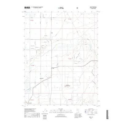
2018 Map of Smith
USGS Topo · Published 2018About this map
Smith Valley serves as a distinct agricultural corridor in western Lyon County, defined by the winding course of the West Walker River and the engineering of the Plymouth Canal. By the late 2010s, the landscape here reflects a combination of traditional ranching and modern rural residential development, evidenced by the dense grid of roads like Hudson Way and Smith Gage Rd surrounding the small settlements of Smith and Wellington. Genealogy and local history are anchored at the Hillcrest Cem, while the northern portion of the quadrangle shows the influence of private aviation at Rosaschi Air Park. The southern boundary transitions into the protected lands of the Toiyabe National Forest, where the terrain begins its ascent away from the irrigated valley floor.
Find a feature on this map
52 named features on this map. Tap any name to fly to it.
Don’t see what you’re looking for? This feature index may not catch every label — zoom into the map to look around manually.
Map Details
Editions of this 2018 Smith Map
This is the sole edition of this map. No revisions or reprints were ever made.
Other maps of this area

1891 · Wellington
USGS Topo · 1:125,000

1893 · Wellington
USGS Topo · 1:125,000

1948 · Walker Lake
USGS Topo · 1:250,000

1956 · Desert Creek Peak
USGS Topo · 1:62,500

1957 · Walker Lake
USGS Topo · 1:250,000

1957 · Wellington
USGS Topo · 1:62,500

1957 · Yerington
USGS Topo · 1:62,500

1958 · Pine Grove Hills
USGS Topo · 1:62,500

1962 · Walker Lake
USGS Topo · 1:250,000

1964 · Walker Lake
USGS Topo · 1:250,000