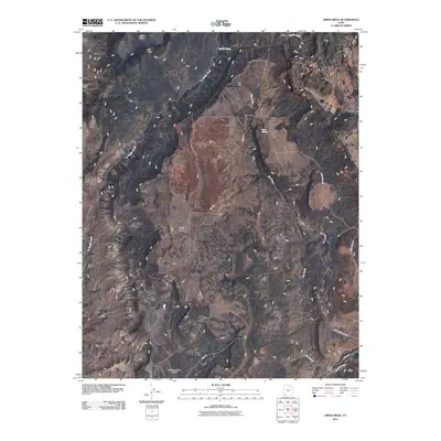
2011 Map of Smith Mesa
USGS Topo · Published 2011About this map
Smith Mesa dominates this 2011 survey, representing a high plateau landscape defined by drainage networks and high-elevation relief. The map documents the southeastern corner of the quadrangle where it meets the boundary of Zion National Park, a transition marked by the descent toward North Creek and Black Wash. Infrastructure is sparse across the mesa, though the network of rural routes such as Mesa Rd and Smith Mesa Rd provide access to this isolated terrain.
Find a feature on this map
14 named features on this map. Tap any name to fly to it.
Don’t see what you’re looking for? This feature index may not catch every label — zoom into the map to look around manually.
Map Details
Editions of this 2011 Smith Mesa Map
This is the sole edition of this map. No revisions or reprints were ever made.
Other maps of this area

1885 · St. George
USGS Topo · 1:250,000

1891 · St. George
USGS Topo · 1:250,000

1953 · Cedar City
USGS Topo · 1:250,000

1954 · La Verkin 4 NW
USGS Topo · 1:24,000

1954 · La Verkin 3 NE
USGS Topo · 1:24,000

1954 · La Verkin 1 SW
USGS Topo · 1:24,000

1954 · La Verkin 2 SE
USGS Topo · 1:24,000

1954 · Hurricane
USGS Topo · 1:62,500

1957 · New Harmony
USGS Topo · 1:62,500

1958 · Cedar City
USGS Topo · 1:250,000