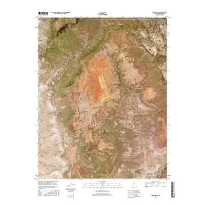
2017 Map of Smith Mesa
USGS Topo · Published 2017About this map
Hurricane Cliffs and the elevated plateau of Smith Mesa define this high-altitude landscape in Washington County. The terrain is a complex of deep drainages and flat-topped mesas, where North Creek and La Verkin Creek carve into the surrounding geology. Human presence is marked by a sparse network of service roads like Mesa Road and Smith Mesa Road, supporting remote ranching or utility access near the western boundary of Zion National Park. Significant water features such as Rock Spring and Lamareaux Tank highlight the necessity of water management in this arid environment. The map also captures the high ground of Hurricane Mesa and the prominent landmark of Red Butte, illustrating the dramatic vertical relief that characterizes the transition from the Black Ridge toward the protected parklands to the east.
Find a feature on this map
26 named features on this map. Tap any name to fly to it.
Don’t see what you’re looking for? This feature index may not catch every label — zoom into the map to look around manually.
Map Details
Editions of this 2017 Smith Mesa Map
This is the sole edition of this map. No revisions or reprints were ever made.
Other maps of this area

1885 · St. George
USGS Topo · 1:250,000

1891 · St. George
USGS Topo · 1:250,000

1953 · Cedar City
USGS Topo · 1:250,000

1954 · La Verkin 4 NW
USGS Topo · 1:24,000

1954 · La Verkin 3 NE
USGS Topo · 1:24,000

1954 · La Verkin 1 SW
USGS Topo · 1:24,000

1954 · La Verkin 2 SE
USGS Topo · 1:24,000

1954 · Hurricane
USGS Topo · 1:62,500

1957 · New Harmony
USGS Topo · 1:62,500

1958 · Cedar City
USGS Topo · 1:250,000