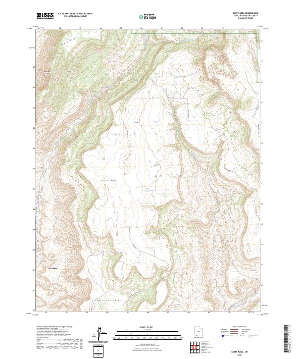
2023 Map of Smith Mesa
USGS Topo · Published 2023About this map
Hurricane Cliffs dominate the western edge of this Washington County landscape, marking the dramatic transition from the La Verkin area to the elevated plateaus above. The map centers on the massive landforms of Smith Mesa and Hurricane Mesa, which are accessible via winding routes like Mesa Rd and Smith Mesa Rd. These high flats are defined by a complex drainage system, including the perennial flow of La Verkin Creek and the seasonally dry beds of Dry Creek.
Find a feature on this map
20 named features on this map. Tap any name to fly to it.
Don’t see what you’re looking for? This feature index may not catch every label — zoom into the map to look around manually.
Map Details
Editions of this 2023 Smith Mesa Map
This is the sole edition of this map. No revisions or reprints were ever made.
Other maps of this area

1885 · St. George
USGS Topo · 1:250,000

1891 · St. George
USGS Topo · 1:250,000

1953 · Cedar City
USGS Topo · 1:250,000

1954 · La Verkin 4 NW
USGS Topo · 1:24,000

1954 · La Verkin 3 NE
USGS Topo · 1:24,000

1954 · La Verkin 1 SW
USGS Topo · 1:24,000

1954 · La Verkin 2 SE
USGS Topo · 1:24,000

1954 · Hurricane
USGS Topo · 1:62,500

1957 · New Harmony
USGS Topo · 1:62,500

1958 · Cedar City
USGS Topo · 1:250,000