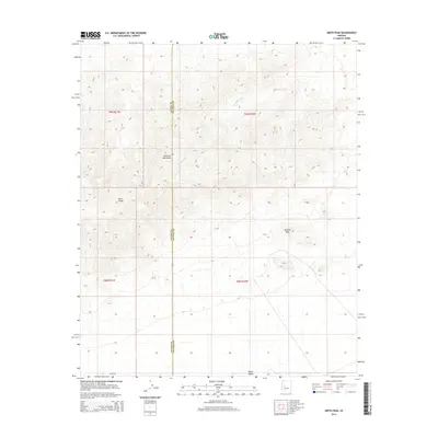
2014 Map of Smith Peak
USGS Topo · Published 2014About this map
The Harcuvar Mountains dominate the western portion of this topographic record, rising sharply above the desert floor to culminate at Smith Peak. This high-altitude perspective of the Arizona desert highlights the stark topography where the mountains meet the northern edge of the Aguila Valley. The landscape is defined by natural drainage patterns, most notably the seasonal course of Miller Wash which cuts through the mountain terrain. Across the southern expanse, Alamo Rd serves as the primary corridor through the valley. This 2014 survey captures the precise border between La Paz and Yavapai Counties, providing a clear delineation of administrative boundaries against the natural backdrop of Bullard Peak.
Find a feature on this map
11 named features on this map. Tap any name to fly to it.
Don’t see what you’re looking for? This feature index may not catch every label — zoom into the map to look around manually.
Map Details
Editions of this 2014 Smith Peak Map
This is the sole edition of this map. No revisions or reprints were ever made.
Other maps of this area

1923 · Signal
USGS Topo · 1:250,000

1942 · Signal
USGS Topo · 1:250,000

1942 · Vicksburg
USGS Topo · 1:250,000

1950 · Prescott
USGS Topo · 1:250,000

1954 · Prescott
USGS Topo · 1:250,000

1954 · Phoenix
USGS Topo · 1:250,000

1957 · Phoenix
USGS Topo · 1:250,000

1958 · Prescott
USGS Topo · 1:250,000

1958 · Phoenix
USGS Topo · 1:250,000

1959 · Prescott
USGS Topo · 1:250,000