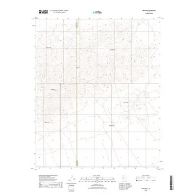
2018 Map of Smith Peak
USGS Topo · Published 2018About this map
Harcuvar Mountains dominate this high-desert landscape, where the peaks of Smith Peak and Bullard Peak serve as primary topographical landmarks. The terrain is defined by a series of steep drainages, most notably Miller Wash, which cuts across the arid northern slopes. Straddling the jurisdictional line between La Paz and Yavapai Counties, the map illustrates a sparsely populated wilderness characterized by significant elevation changes and seasonal watercourses. The 2018 survey detail reflects the modern preservation of this open desert range, showcasing the complex network of contour lines that define these summits and the expansive township and range grid system including t9n r11w, t9n r10w, t8n r11w, and t8n r10w.
Find a feature on this map
9 named features on this map. Tap any name to fly to it.
Don’t see what you’re looking for? This feature index may not catch every label — zoom into the map to look around manually.
Map Details
Editions of this 2018 Smith Peak Map
This is the sole edition of this map. No revisions or reprints were ever made.
Other maps of this area

1923 · Signal
USGS Topo · 1:250,000

1942 · Signal
USGS Topo · 1:250,000

1942 · Vicksburg
USGS Topo · 1:250,000

1950 · Prescott
USGS Topo · 1:250,000

1954 · Prescott
USGS Topo · 1:250,000

1954 · Phoenix
USGS Topo · 1:250,000

1957 · Phoenix
USGS Topo · 1:250,000

1958 · Prescott
USGS Topo · 1:250,000

1958 · Phoenix
USGS Topo · 1:250,000

1959 · Prescott
USGS Topo · 1:250,000