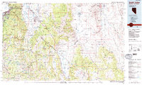
1985 Map of Smith Valley
USGS Topo · Published 1985About this map
The Pine Nut Mountains and the Carson Range frame this high-desert landscape during the mid-1980s, revealing the complex water and mineral geography of the Nevada-California border. Settled basins like Antelope Valley and Smith Valley are contrasted with the high-elevation peaks of the Toiyabe National Forest. The map documents a significant mining legacy in the eastern ranges, including the Leviathan Mine and the Mason Valley Mine, while the western edge shows the development around South Lake Tahoe and Zephyr Cove. Irrigation patterns are clearly visible through the network of sloughs and ditches serving Minden and Gardnerville, where Brockliss Slough and Martin Slough distribute water from the Carson River. This survey captures the region just as recreational and residential growth began to shift the character of these traditional ranching and mining valleys.
Find a feature on this map
160 named features on this map. Tap any name to fly to it.
Don’t see what you’re looking for? This feature index may not catch every label — zoom into the map to look around manually.
Map Details
Editions of this 1985 Smith Valley Map
2 editions found
Other maps of this area

1889 · Pyramid Peak
USGS Topo · 1:125,000

1889 · Markleeville
USGS Topo · 1:125,000

1891 · Carson
USGS Topo · 1:125,000

1891 · Markleeville
USGS Topo · 1:125,000

1891 · Truckee
USGS Topo · 1:125,000

1891 · Big Trees
USGS Topo · 1:125,000

1891 · Wabuska
USGS Topo · 1:125,000

1891 · Pyramid Peak
USGS Topo · 1:125,000

1891 · Wellington
USGS Topo · 1:125,000

1893 · Carson
USGS Topo · 1:125,000