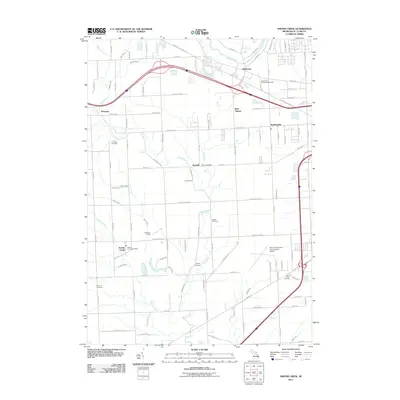
2011 Map of Smiths Creek
USGS Topo · Published 2011About this map
Smiths Creek and its neighboring hamlets define the landscape of St. Clair County as it was recorded in the early twenty-first century. The area is intersected by the winding Pine River and Black River, which dictate the local topography alongside a dense network of agricultural drains such as Morris Drain and Wolvin Drain. For those tracing local families, the map provides precise locations for numerous small burial grounds, including Caswell Cemetery, Moore Cemetery, and Mallory Cemetery. Transport and infrastructure are prominent, with the Wadhams to Avoca Trl cutting across the northern half and the Saint Clair County International Airport occupying a significant footprint to the east. Small communities like Thornton, West Tappan, and Kimball appear amidst a grid of rural roads and residential clusters such as Sparlingville, showcasing the blend of rural tradition and modern transit corridors including Interstate 69 and the Smiths Creek Post Office.
Find a feature on this map
100 named features on this map. Tap any name to fly to it.
Don’t see what you’re looking for? This feature index may not catch every label — zoom into the map to look around manually.
Map Details
Editions of this 2011 Smiths Creek Map
This is the sole edition of this map. No revisions or reprints were ever made.
Other maps of this area

1912 · Port Huron
USGS Topo · 1:62,500

1928 · Hicky
USGS Topo · 1:62,500

1929 · Port Huron
USGS Topo · 1:62,500

1936 · St. Clair
USGS Topo · 1:31,680

1936 · Rattle Run
USGS Topo · 1:31,680

1939 · Adair
USGS Topo · 1:24,000

1939 · Port Huron
USGS Topo · 1:24,000

1939 · St. Clair
USGS Topo · 1:24,000

1939 · Smiths Creek
USGS Topo · 1:24,000

1939 · Goodells
USGS Topo · 1:24,000