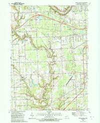
1991 Map of Smiths Creek
USGS Topo · Published 1991About this map
St Clair County International Airport serves as a modern anchor in this landscape of St. Clair County, which transitions from the northern conservation lands of the Port Huron State Game Area toward the residential pockets of Sparlingville and Smiths Creek. The terrain is defined by an intricate network of drainage channels and small waterways, including the Black River and Pine River, which supported the early agricultural layout of the region.
Find a feature on this map
58 named features on this map. Tap any name to fly to it.
Don’t see what you’re looking for? This feature index may not catch every label — zoom into the map to look around manually.
Map Details
Editions of this 1991 Smiths Creek Map
This is the sole edition of this map. No revisions or reprints were ever made.
Other maps of this area

1912 · Port Huron
USGS Topo · 1:62,500

1928 · Hicky
USGS Topo · 1:62,500

1929 · Port Huron
USGS Topo · 1:62,500

1936 · St. Clair
USGS Topo · 1:31,680

1936 · Rattle Run
USGS Topo · 1:31,680

1939 · Adair
USGS Topo · 1:24,000

1939 · Port Huron
USGS Topo · 1:24,000

1939 · St. Clair
USGS Topo · 1:24,000

1939 · Smiths Creek
USGS Topo · 1:24,000

1939 · Goodells
USGS Topo · 1:24,000