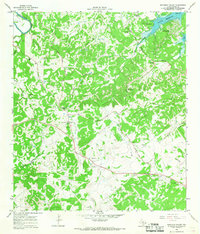
1964 Map of Smithson Valley
USGS Topo · Published 1968About this map
Canyon Reservoir dominates the northeastern corner of this landscape, its rising waters reshaping the Comal County hill country as it appeared in the mid-1960s. The area is a network of deeply etched drainages like Tom Creek and Rebecca Creek, where small family-named settlements and cemeteries preserve the genealogy of early Texas settlers. The central community of Smithson Valley is anchored by the Smithson Valley Cem, while further west, the Sherwood Sch stands as a local landmark.
Find a feature on this map
35 named features on this map. Tap any name to fly to it.
Don’t see what you’re looking for? This feature index may not catch every label — zoom into the map to look around manually.
Map Details
Editions of this 1964 Smithson Valley Map
3 editions found
Other maps of this area

1920 · Smithsons Valley
USGS Topo · 1:62,500

1925 · Hunter No 3
USGS Topo · 1:48,000

1925 · Smithson Valley No. 1
USGS Topo · 1:48,000

1927 · New Braunfels
USGS Topo · 1:62,500

1927 · Smithson Valley
USGS Topo · 1:62,500

1929 · Hunter
USGS Topo · 1:62,500

1929 · Smithson Valley
USGS Topo · 1:62,500

1940 · Smithson Valley
USGS Topo · 1:62,500

1953 · Bulverde
USGS Topo · 1:24,000

1953 · Bat Cave
USGS Topo · 1:24,000