Loading...
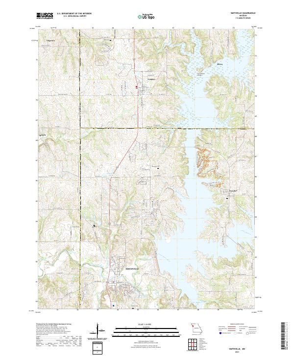
Loading map...2021 Map of Smithville
USGS Topo · Published 2021About this map
The Little Platte River system dominates this landscape at the intersection of Platte, Clinton, and Clay Counties. The town of Smithville serves as the primary hub, surrounded by smaller communities such as Trimble, Paradise, and Edgerton. This map reveals a complex water network shaped by the winding river and its many tributaries, including Linn Branch and Camp Branch, which feed into sprawling reservoir waters.
Find a feature on this map
132 named features on this map. Tap any name to fly to it.
Don’t see what you’re looking for? This feature index may not catch every label — zoom into the map to look around manually.
Map Details
Date Portrayed2021
Date Published2021
PublisherU.S. Geological Survey
Map TypeTopographic
Scale1:24000
Physical Dimensions24 x 29 inches
Editions of this 2021 Smithville Map
This is the sole edition of this map. No revisions or reprints were ever made.
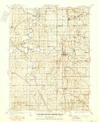
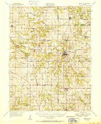
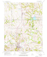
Historical Maps of Paradise Through Time
5 maps found

Featured Locations
Source Details
SourceU.S. Geological Survey
CopyrightPublic Domain