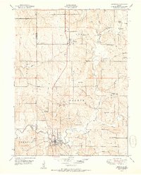
1951 Map of Smithville
USGS Topo · Published 1951About this map
Smithville serves as the focal point of this 1951 survey, situated at the confluence of Second Creek and the winding Platte River. The landscape is characterized by a dense network of rural infrastructure, including a variety of one-room schoolhouses like Rocky Point School, Lott School, and Fry School that anchored these farming communities before the era of school consolidation. The topography is defined by numerous drainage systems such as Duncan Branch and Owens Branch that feed into the river valley, while early transportation links are marked by the Rice Bridge and Hixson Bridge. Genealogists will find considerable value in the identified family and community burial grounds, including the Reed Cemetery and Gaus Cemetery, as well as established centers of worship like Stony Point Church and Pleasant Hill Church. Smaller settlements like Trimble and Paradise provide further points of historical reference for this Clay and Clinton County borderland.
Find a feature on this map
42 named features on this map. Tap any name to fly to it.
Don’t see what you’re looking for? This feature index may not catch every label — zoom into the map to look around manually.
Map Details
Editions of this 1951 Smithville Map
2 editions found
Other maps of this area

1890 · Kansas City
USGS Topo · 1:125,000

1894 · Kansas City
USGS Topo · 1:125,000

1894 · Independence
USGS Topo · 1:125,000

1914 · Smithville
USGS Topo · 1:62,500

1925 · Gower
USGS Topo · 1:62,500

1925 · Plattsburg
USGS Topo · 1:62,500

1936 · Kearney
USGS Topo · 1:48,000

1942 · Kearney
USGS Topo · 1:62,500

1945 · Kearney
USGS Topo · 1:62,500
1948 · Nashua
USGS Topo · 1:24,000