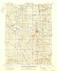
1914 Map of Smithville
USGS Topo · Published 1950About this map
The Platte River and its major tributary, the Little Platte River, dominate this Missouri landscape, which is marked by a complex network of early 20th-century transportation and small rural settlements. This 1914 survey, updated with 1949 highway data, documents a transition in regional travel as the Interstate Trail and emerging roads began to supersede the railroad corridors. Several rail lines are already noted as defunct by this era, including the Chicago Rock Island and Pacific and the Quincy Omaha and Kansas City.
Find a feature on this map
91 named features on this map. Tap any name to fly to it.
Don’t see what you’re looking for? This feature index may not catch every label — zoom into the map to look around manually.
Map Details
Editions of this 1914 Smithville Map
4 editions found
Other maps of this area

1890 · Kansas City
USGS Topo · 1:125,000

1894 · Kansas City
USGS Topo · 1:125,000

1894 · Independence
USGS Topo · 1:125,000

1910 · Leavenworth
USGS Topo · 1:62,500

1914 · Smithville
USGS Topo · 1:62,500

1925 · Gower
USGS Topo · 1:62,500

1925 · Plattsburg
USGS Topo · 1:62,500

1927 · Dearborn
USGS Topo · 1:62,500

1934 · Bonner Springs
USGS Topo · 1:48,000

1934 · Wolcott
USGS Topo · 1:24,000