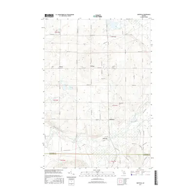
2017 Map of Smithville
USGS Topo · Published 2017About this map
The Manistee River winds through this northern Michigan landscape, providing a primary geographical anchor for the rural communities of Smithville and Taffeltown. The terrain is defined by a glacial history of kettle lakes and wetlands, seen in features like Twentyeight Lakes, Woodard Lake, and the expansive East Lake Swamp. High points like Twentyone Hill overlook a network of section-line roads and family-named routes such as Puffer Rd SW and Shively Rd.
Find a feature on this map
84 named features on this map. Tap any name to fly to it.
Don’t see what you’re looking for? This feature index may not catch every label — zoom into the map to look around manually.
Map Details
Editions of this 2017 Smithville Map
This is the sole edition of this map. No revisions or reprints were ever made.
Other maps of this area

1954 · Traverse City
USGS Topo · 1:250,000

1956 · Kalkaska
USGS Topo · 1:62,500

1956 · Fife Lake
USGS Topo · 1:62,500

1956 · Cadillac North
USGS Topo · 1:62,500

1956 · Lake City
USGS Topo · 1:62,500

1958 · Traverse City
USGS Topo · 1:250,000

1983 · Cadillac
USGS Topo · 1:100,000

1983 · Stittsville
USGS Topo · 1:24,000

1983 · Traverse City
USGS Topo · 1:100,000
1983 · Morey
USGS Topo · 1:25,000