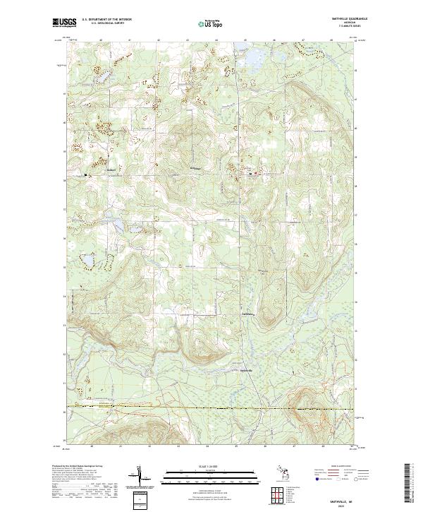
2023 Map of Smithville
USGS Topo · Published 2023About this map
The Manistee River carves a winding path across this landscape, serving as a focal point for local activity near the settlement of Smithville. This area, situated along the boundary between Kalkaska and Missaukee Counties, is characterized by a high density of small kettle lakes and wetlands, including Woodard Lake, Ingersoll Lake, and Jones Lake. Small rural communities such as Taffeltown, Giddings, and Deibert are connected by a network of sectional roads like W Sharon Rd. Family and local history researchers will find the locations of the Deibert Cem and Garfield Cem particularly useful. The terrain is marked by distinctive elevations like Twentyone Hill, which overlooks the surrounding basins and the headwaters of Nelson Creek and Waterhole Creek.
Find a feature on this map
94 named features on this map. Tap any name to fly to it.
Don’t see what you’re looking for? This feature index may not catch every label — zoom into the map to look around manually.
Map Details
Editions of this 2023 Smithville Map
This is the sole edition of this map. No revisions or reprints were ever made.
Other maps of this area

1954 · Traverse City
USGS Topo · 1:250,000

1956 · Kalkaska
USGS Topo · 1:62,500

1956 · Fife Lake
USGS Topo · 1:62,500

1956 · Cadillac North
USGS Topo · 1:62,500

1956 · Lake City
USGS Topo · 1:62,500

1958 · Traverse City
USGS Topo · 1:250,000

1983 · Cadillac
USGS Topo · 1:100,000

1983 · Stittsville
USGS Topo · 1:24,000

1983 · Traverse City
USGS Topo · 1:100,000
1983 · Morey
USGS Topo · 1:25,000