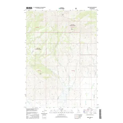
2017 Map of Smoky Dome
USGS Topo · Published 2017About this map
Smoky Dome and the peaks of the Soldier Mountains dominate this high-elevation Idaho landscape within the Sawtooth National Forest. The map details a complex drainage system where the headwaters of Corral Cr, McMahan Cr, and the various forks of Threemile Cr descend from the ridges toward the Camas Prairie. Near the southern edge of the survey, the land levels out, revealing sites of local historical interest such as the Corral Cem and a Hot Spring near Lansing Cr. This transition from the high-altitude Smoky Loop and Sheep Point to the ranching and timber access roads like Corral Creek Rd and Homestead Rd illustrates the interplay between Idaho's protected wilderness and the foothill agricultural zones.
Find a feature on this map
33 named features on this map. Tap any name to fly to it.
Don’t see what you’re looking for? This feature index may not catch every label — zoom into the map to look around manually.
Map Details
Editions of this 2017 Smoky Dome Map
This is the sole edition of this map. No revisions or reprints were ever made.
Other maps of this area

1892 · Camas Prairie
USGS Topo · 1:125,000

1893 · Camas Prairie
USGS Topo · 1:125,000

1894 · Rocky Bar
USGS Topo · 1:125,000

1900 · Sawtooth
USGS Topo · 1:125,000

1955 · Hailey
USGS Topo · 1:250,000

1957 · Fairfield
USGS Topo · 1:62,500

1959 · Hailey
USGS Topo · 1:250,000

1962 · Hailey
USGS Topo · 1:250,000

1963 · Deer Mountain
USGS Topo · 1:24,000

1963 · Hill City
USGS Topo · 1:24,000