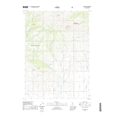
2020 Map of Smoky Dome
USGS Topo · Published 2020About this map
The high ridges of the Soldier Mountains dominate this portion of Camas County, reaching a literal peak at Smoky Dome. Located within the Sawtooth National Forest, the landscape is defined by a dense network of drainage systems, including Rough Cr and Corral Cr, which flow south toward the valley floor. Historically, these corridors served as vital transit routes for livestock and travelers, evidenced by the Boardman Driveway and specialized paths like Front Trail E - Atv. In the southern reaches where the elevation begins to level, the Corral Cem and the presence of a Hot Spring mark the points of early human interest and settlement. This map documents a high-altitude wilderness where modern recreation trails and historic livestock driveways intersect among landmarks like Sheep Point.
Find a feature on this map
34 named features on this map. Tap any name to fly to it.
Don’t see what you’re looking for? This feature index may not catch every label — zoom into the map to look around manually.
Map Details
Editions of this 2020 Smoky Dome Map
This is the sole edition of this map. No revisions or reprints were ever made.
Other maps of this area

1892 · Camas Prairie
USGS Topo · 1:125,000

1893 · Camas Prairie
USGS Topo · 1:125,000

1894 · Rocky Bar
USGS Topo · 1:125,000

1900 · Sawtooth
USGS Topo · 1:125,000

1955 · Hailey
USGS Topo · 1:250,000

1957 · Fairfield
USGS Topo · 1:62,500

1959 · Hailey
USGS Topo · 1:250,000

1962 · Hailey
USGS Topo · 1:250,000

1963 · Deer Mountain
USGS Topo · 1:24,000

1963 · Hill City
USGS Topo · 1:24,000