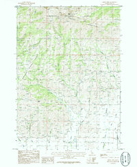
1986 Map of Smoky Dome
USGS Topo · Published 1986About this map
Smoky Dome stands as the prominent peak within the Soldier Mountains in this mid-1980s topographical record of south-central Idaho. The landscape is defined by the high elevations of the Sawtooth National Forest and the northern reaches of the Camas Prairie. Complex drainage patterns are visible through the numerous waterways flowing south, including Lime Creek, Rough Creek, and Corral Creek. A small, isolated Cem (cemetery) located in the lower elevations suggests early high-altitude ranching or pioneer activity near the forest boundary. The transition from the high ridges at Sheep Point down to the relatively level plains of the prairie illustrates the geography that supported both seasonal grazing and timber management in this Idaho backcountry. Numerous 4WD trails and unimproved roads trace the drainages of Lansing Creek and Threemile Creek, providing a detailed look at the infrastructure of the era's land use.
Find a feature on this map
20 named features on this map. Tap any name to fly to it.
Don’t see what you’re looking for? This feature index may not catch every label — zoom into the map to look around manually.
Map Details
Editions of this 1986 Smoky Dome Map
This is the sole edition of this map. No revisions or reprints were ever made.
Other maps of this area

1892 · Camas Prairie
USGS Topo · 1:125,000

1893 · Camas Prairie
USGS Topo · 1:125,000

1894 · Rocky Bar
USGS Topo · 1:125,000

1900 · Sawtooth
USGS Topo · 1:125,000

1955 · Hailey
USGS Topo · 1:250,000

1957 · Fairfield
USGS Topo · 1:62,500

1959 · Hailey
USGS Topo · 1:250,000

1962 · Hailey
USGS Topo · 1:250,000

1963 · Deer Mountain
USGS Topo · 1:24,000

1963 · Hill City
USGS Topo · 1:24,000