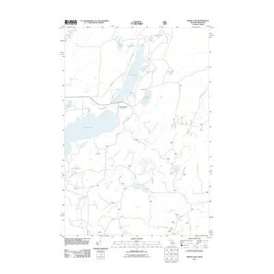
2011 Map of Smoky Lake
USGS Topo · Published 2011About this map
Smoky Lake and Big Sand Lake dominate this glacial landscape on the Michigan-Wisconsin border, where the forest canopy is broken by a dense network of smaller basins like Ishkote Lake, Kaine Lake, and Robinson Lake. The area reflects a transition from recreational wilderness to a managed forest landscape, evidenced by the numerous U.S. Forest Service roads such as USFS Rd 3110 and Kaine Lake Rd. A modest cluster of development is visible at Holmes Park on the southern shore of Smoky Lake, while the Phelps Municipal Landing Strip serves as a critical connection point for this lake-strewn region. The winding course of Elvoy Creek and Little Smoky Creek provides the drainage for the complex topography, connecting isolated water bodies like Secret Lake and Jewel Lake to the larger watershed. This survey captures the rural character of Vilas County at the start of the 2010s, showing the intersection of local lake life and state-boundary land management.
Find a feature on this map
45 named features on this map. Tap any name to fly to it.
Don’t see what you’re looking for? This feature index may not catch every label — zoom into the map to look around manually.
Map Details
Editions of this 2011 Smoky Lake Map
This is the sole edition of this map. No revisions or reprints were ever made.
Other maps of this area

1928 · Three Lakes
USGS Topo · 1:48,000

1938 · Phelps
USGS Topo · 1:48,000

1938 · Alvin
USGS Topo · 1:48,000

1938 · Three Lakes
USGS Topo · 1:48,000

1945 · Three Lakes
USGS Topo · 1:48,000

1946 · Alvin
USGS Topo · 1:48,000

1950 · Phelps
USGS Topo · 1:48,000

1954 · Iron Mountain
USGS Topo · 1:250,000

1956 · Beechwood
USGS Topo · 1:62,500

1956 · Phelps
USGS Topo · 1:62,500