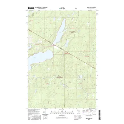
2017 Map of Smoky Lake
USGS Topo · Published 2017About this map
Smoky Lake straddles the state line between Michigan and Wisconsin, serving as a central hub for a densely forested landscape defined by glacial lakes and federal land management. In this 2017 survey, the terrain is split between the Ottawa National Forest to the north and the Nicolet National Forest to the south. This boundary region is marked by a complex network of forest roads and national forest system trails like Nfst 3219, which provide access to more secluded water bodies such as Kaine Lake, Robinson Lake, and the remote Secret Lake. The hydrological pattern is particularly intricate near Big Sand Lake, where the Deerskin River flows amidst several smaller ponds and marshes. Local naming conventions are evident in family-linked roads such as Konitzer Rd and Fishel Rd, which intersect the managed timberlands near Elvoy Springs.
Find a feature on this map
61 named features on this map. Tap any name to fly to it.
Don’t see what you’re looking for? This feature index may not catch every label — zoom into the map to look around manually.
Map Details
Editions of this 2017 Smoky Lake Map
This is the sole edition of this map. No revisions or reprints were ever made.
Other maps of this area

1928 · Three Lakes
USGS Topo · 1:48,000

1938 · Phelps
USGS Topo · 1:48,000

1938 · Alvin
USGS Topo · 1:48,000

1938 · Three Lakes
USGS Topo · 1:48,000

1945 · Three Lakes
USGS Topo · 1:48,000

1946 · Alvin
USGS Topo · 1:48,000

1950 · Phelps
USGS Topo · 1:48,000

1954 · Iron Mountain
USGS Topo · 1:250,000

1956 · Beechwood
USGS Topo · 1:62,500

1956 · Phelps
USGS Topo · 1:62,500