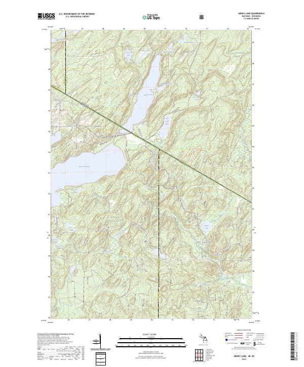
2023 Map of Smoky Lake
USGS Topo · Published 2023About this map
Smoky Lake sits at the heart of this Northwoods landscape, straddling the state line where Ottawa National Forest in Michigan meets the Nicolet National Forest in Wisconsin. The map captures a water-rich terrain of glacial kettle lakes and winding creeks, including Ishkote Lake, Big Sand Lake, and the headwaters of the Deerskin River. A network of specialized forest roads and trails, such as Mail Route Road and the Vilas Co Snowmobile Trl, provides access to these timberlands and recreational waters. Along the southern reaches, Elvoy Springs feeds into Elvoy Creek, illustrating the complex hydrology of the Iron and Vilas county borderlands. The presence of features like the Big Sand Lake Boat Landing Rd highlights the area's long-standing transition from industrial timber harvesting toward seasonal residence and outdoor recreation.
Find a feature on this map
68 named features on this map. Tap any name to fly to it.
Don’t see what you’re looking for? This feature index may not catch every label — zoom into the map to look around manually.
Map Details
Editions of this 2023 Smoky Lake Map
This is the sole edition of this map. No revisions or reprints were ever made.
Other maps of this area

1928 · Three Lakes
USGS Topo · 1:48,000

1938 · Phelps
USGS Topo · 1:48,000

1938 · Alvin
USGS Topo · 1:48,000

1938 · Three Lakes
USGS Topo · 1:48,000

1945 · Three Lakes
USGS Topo · 1:48,000

1946 · Alvin
USGS Topo · 1:48,000

1950 · Phelps
USGS Topo · 1:48,000

1954 · Iron Mountain
USGS Topo · 1:250,000

1956 · Beechwood
USGS Topo · 1:62,500

1956 · Phelps
USGS Topo · 1:62,500