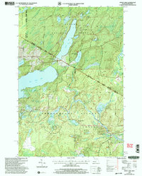
1999 Map of Smoky Lake
USGS Topo · Published 2004About this map
The northern borderlands between Michigan and Wisconsin are defined here by a dense concentration of glacial lakes and managed timberlands. This landscape is split between the Ottawa National Forest in the north and the Nicolet National Forest to the south, with the state line bisecting the region. Water dominates the terrain, from the large expanse of Big Sand Lake to the elongated Smoky Lake. The presence of the Phelps Municipal Landing Strip and several public boat ramps indicates the area's mid-century development as a hub for remote recreational aviation and fishing. Local industry is subtly present through several Gravel Pits and the Private Road networks used for forest management. Small, secluded waters like Kaine Lake and Jewel Lake are tucked into the undulating topography, while Elvoy Creek drains the southeastern reaches of the map.
Find a feature on this map
36 named features on this map. Tap any name to fly to it.
Don’t see what you’re looking for? This feature index may not catch every label — zoom into the map to look around manually.
Map Details
Editions of this 1999 Smoky Lake Map
This is the sole edition of this map. No revisions or reprints were ever made.
Other maps of this area

1928 · Three Lakes
USGS Topo · 1:48,000

1938 · Phelps
USGS Topo · 1:48,000

1938 · Alvin
USGS Topo · 1:48,000

1938 · Three Lakes
USGS Topo · 1:48,000

1945 · Three Lakes
USGS Topo · 1:48,000

1946 · Alvin
USGS Topo · 1:48,000

1950 · Phelps
USGS Topo · 1:48,000

1954 · Iron Mountain
USGS Topo · 1:250,000

1956 · Beechwood
USGS Topo · 1:62,500

1956 · Phelps
USGS Topo · 1:62,500