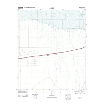
2011 Map of Smurr
USGS Topo · Published 2011About this map
Smurr sits at a critical junction of transport and desert hydrology in Maricopa County, positioned along the southern reach of the Gila River. The landscape is defined by the transition from irrigated agricultural grids in the north, evidenced by roads like Sisson Rd and Watermelon Rd, to the alluvial fan systems of the south. Dramatic dry watercourses, notably Sauceda Wash and Quilotosa Wash, carve through the terrain as they drain toward the river valley. The corridor is dominated by modern infrastructure, including the Citrus Valley Interchange, while the northern boundary is anchored by the prominent Point of Rocks. This 2011 survey illustrates the precarious balance between desert reclamation and the vast, unchanneled drainage basins that characterize the region's geography.
Find a feature on this map
21 named features on this map. Tap any name to fly to it.
Don’t see what you’re looking for? This feature index may not catch every label — zoom into the map to look around manually.
Map Details
Editions of this 2011 Smurr Map
This is the sole edition of this map. No revisions or reprints were ever made.
Other maps of this area

1950 · Theba
USGS Topo · 1:62,500

1951 · Gila Bend
USGS Topo · 1:62,500

1951 · Theba
USGS Topo · 1:62,500

1951 · Cotton Center
USGS Topo · 1:62,500

1951 · Woolsey Peak
USGS Topo · 1:62,500

1953 · Ajo
USGS Topo · 1:250,000

1954 · Phoenix
USGS Topo · 1:250,000

1957 · Ajo
USGS Topo · 1:250,000

1957 · Phoenix
USGS Topo · 1:250,000

1958 · Ajo
USGS Topo · 1:250,000