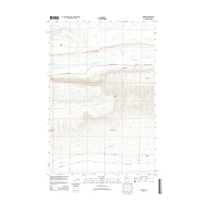
2013 Map of Smyrna
USGS Topo · Published 2013About this map
Smyrna sits at the base of the dramatic rise toward the Saddle Mountains, marking a transition from the lower riparian corridor to the elevated basalt plateaus of central Washington. This 2013 survey illustrates a landscape defined by the winding path of Lower Crab Creek and the organized water management of the Royal Rd Canal-Wasteway. The terrain is characterized by massive geographical features like the Smyrna Bench and the Wahluke Slope, which dictate the placement of local infrastructure such as Lower Crab Creek Rd SW. The presence of Schrum Ranch and isolated water bodies like Sand Hollow Lake highlights the agricultural and ranching foundations of the area. Notable landmarks such as Dry Island provide evidence of the ancient floodwaters that carved this region's distinct coulees and benches.
Find a feature on this map
17 named features on this map. Tap any name to fly to it.
Don’t see what you’re looking for? This feature index may not catch every label — zoom into the map to look around manually.
Map Details
Editions of this 2013 Smyrna Map
This is the sole edition of this map. No revisions or reprints were ever made.
Other maps of this area

1911 · Red Rock
USGS Topo · 1:62,500

1912 · Beverly
USGS Topo · 1:62,500

1916 · Coyote Rapids
USGS Topo · 1:62,500

1917 · Priest Rapids
USGS Topo · 1:62,500

1950 · Smyrna
USGS Topo · 1:62,500

1951 · Priest Rapids
USGS Topo · 1:62,500

1951 · Smyrna
USGS Topo · 1:62,500

1951 · Coyote Rapids
USGS Topo · 1:62,500

1953 · Walla Walla
USGS Topo · 1:250,000

1954 · Beverly NE
USGS Topo · 1:24,000