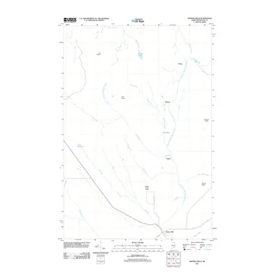
2011 Map of Smyrna Mills
USGS Topo · Published 2011About this map
Smyrna Mills serves as the primary hub for this Aroostook County landscape, situated where Colbroth Brook meets the East Branch Mattawamkeag River. The area is defined by a series of parallel waterways and ridges that speak to the region's timber and transport history. To the north, small named locales like Hillman, Shorey, and Emerson Siding align with the river corridor, while inland tracts such as Big Brawn and Little Brawn indicate the division of forest lands. The terrain is marked by significant rises including Dudley Brook Ridge and Pervere Ridge, with drainage systems like Dudley Brook, Soule Brook, and Moose Brook feeding the Mattawamkeag. Water features such as Brandy Pond and Read Lake dot the northern and western reaches, providing a clear record of the hydrography and elevation around the settlement of Dudley at the start of the 21st century.
Find a feature on this map
26 named features on this map. Tap any name to fly to it.
Don’t see what you’re looking for? This feature index may not catch every label — zoom into the map to look around manually.
Map Details
Editions of this 2011 Smyrna Mills Map
This is the sole edition of this map. No revisions or reprints were ever made.
Other maps of this area

1935 · Howe Brook
USGS Topo · 1:48,000

1937 · Smyrna Mills
USGS Topo · 1:62,500

1939 · Howe Brook
USGS Topo · 1:62,500

1940 · Island Falls
USGS Topo · 1:62,500

1940 · Oxbow
USGS Topo · 1:62,500

1942 · Island Falls
USGS Topo · 1:62,500

1942 · Oxbow
USGS Topo · 1:62,500

1954 · Howe Brook
USGS Topo · 1:62,500

1954 · Presque Isle
USGS Topo · 1:250,000

1955 · Smyrna Mills
USGS Topo · 1:62,500