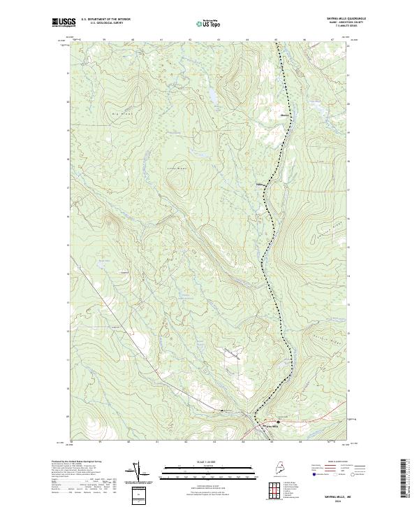
2024 Map of Smyrna Mills
USGS Topo · Published 2024About this map
The East Branch Mattawamkeag River meanders through this portion of Aroostook County, defining a landscape of sprawling wetlands and high ridges. The settlement of Smyrna Mills serves as the primary hub in the south, where Mission St and Moro 441 converge near the riverbanks. Local history and genealogy are anchored by the Smyrna Mills Cem and Merrill Cem, while smaller clusters like Shorey and Hillman mark the path toward the northern timberlands.
Find a feature on this map
42 named features on this map. Tap any name to fly to it.
Don’t see what you’re looking for? This feature index may not catch every label — zoom into the map to look around manually.
Map Details
Editions of this 2024 Smyrna Mills Map
This is the sole edition of this map. No revisions or reprints were ever made.
Other maps of this area

1935 · Howe Brook
USGS Topo · 1:48,000

1937 · Smyrna Mills
USGS Topo · 1:62,500

1939 · Howe Brook
USGS Topo · 1:62,500

1940 · Island Falls
USGS Topo · 1:62,500

1940 · Oxbow
USGS Topo · 1:62,500

1942 · Island Falls
USGS Topo · 1:62,500

1942 · Oxbow
USGS Topo · 1:62,500

1954 · Howe Brook
USGS Topo · 1:62,500

1954 · Presque Isle
USGS Topo · 1:250,000

1955 · Smyrna Mills
USGS Topo · 1:62,500